Bagerhat district
4 parliamentary seats · 9 upazilas. The current member for each seat, according to Parliament's database.
About Bagerhat district
Bagerhat District is a district in south-western Bangladesh. It is a part of Khulna Division.
History
Bagerhat city is famous for its mosques. Muslim saint Khan Jahan Ali founded this town. He was a saint of the 15th century, possibly of Turkic origin. At the time of his reign, Bagerhat was a part of the Sundarbans. He cleared the forest and made it habitable. He erected many official buildings to run his administration. He also built many mosques and dug tanks. The buildings erected by him are now all in ruins. The city of Bagerhat has been given the status of a World Heritage Site by UNESCO in 1973. Khan was a military general that was appointed to be the leader of the city and was greatly respected.
Geography
It is bounded by Gopalganj District and Narail District on the north, The Bay of Bengal on the south, Gopalganj District, Pirojpur District and Barguna District on the east and Khulna District on the west. The main rivers of the district are the Panguchi, Daratana, Madhumati River, Pasur River, Haringhata, Mongla River, Baleshwar, Bangra and Goshairkhali.
People
According to the 2022 Bangladeshi census, Bagerhat District had 408,840 households and a population of 1,613,076. The population density was 407 people per km2. Bagerhat District had a literacy rate of 81.42%, compared to the national average of 74.80%, and a sex ratio of 98.97 males per 100 females. 279,751 inhabitants were under 10 years of age.
Economy
Port of Mongla, which is a port of Khulna city and one of the two main sea ports of Bangladesh, is geographically located in Bagerhat District. Rampal and Fakirhat, two upazilas of Bagerhat, are renowned in Bangladesh due to their huge production of shrimp and a big amount of foreign exchange through the city of Khulna.
Source: Wikipedia, Bagerhat District · CC BY-SA 4.0
Map of the district
Boundaries from the Election Commission's description of the seats, drawn on the maps of OpenStreetMap (upazilas), OCHA (city corporations) and geoBoundaries (city wards; BBS, 2015); approximate. Background map from OpenStreetMap. 4 seats; tap an area to open that seat's page.


Seats and their members
Bagerhat is a district in Khulna division with 4 seats in Parliament: Bagerhat-1 (Fakirhat, Mollahat and Chitalmari upazilas), Bagerhat-2 (Bagerhat Sadar and Kachua upazilas), Bagerhat-3 (Rampal and Mongla upazilas) and Bagerhat-4 (Morrelganj and Sarankhola upazilas). In the 13th Parliament, of these seats Jamaat-e-Islami holds 3 and the BNP 1. In the 12th Parliament (2024) the seats were all held by the Awami League.
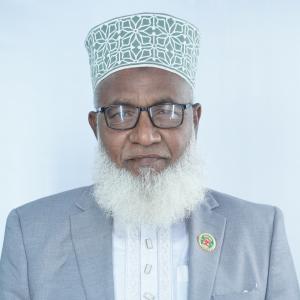 Md Moshiur Rahman KhanBagerhat-1, Jamaat-e-Islami
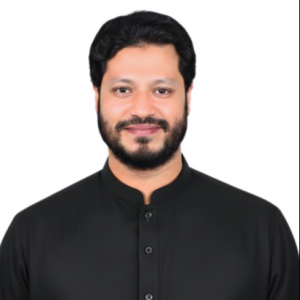 Shaikh Monzurul Haque RahadBagerhat-2, Jamaat-e-Islami
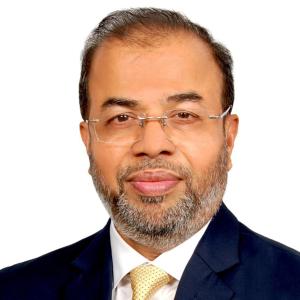 Shaikh Faridul IslamBagerhat-3, BNP
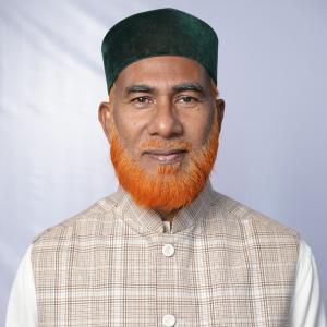 Md. Abdul AleemBagerhat-4, Jamaat-e-Islami
Source: Parliament of Bangladesh | Updated 24 October 2026