Brahmanbaria district
6 parliamentary seats · 9 upazilas. The current member for each seat, according to Parliament's database.
About Brahmanbaria district
Brahmanbaria District is a district in eastern Bangladesh located in the Chittagong Division. Geographically, it is mostly farmland and is topographically part of the Gangetic Plain. It is bounded by the districts of Kishoreganj and Habiganj to the north, Narsingdi District and Narayanganj to the west, Comilla to the south, and the Indian state of Tripura to the east. It was a part of Comilla District until 15 February 1984.
History
Brahmanbaria was a part of Samatata region of ancient Bengal. Before the reign of Alauddin Husain Shah, the sultan of Bengal, Brahmanbaria was part of Tripura. In 1513, Husain Shah defeated the king of Tripura, Dhanya Manikya, in battle, and succeeded to annex at least some portion of the territory of Tripura, which included modern Brahmanbaria. He also established the fort of Kaliagarh in Tripuri territory. The area Syed Mahmud resided in was named Kazipara after him, and his mazar remains there. The leader of the Baro-Bhuiyan zamindars, Isa Khan, had his first and temporary capital situated in Sarail.
People
According to the 2022 Census of Bangladesh, Brahmanbaria District had 712,578 households and a population of 3,306,563 with an average of 4.57 people per household. Among the population, 798,979 inhabitants were under 10 years of age. The population density was 1,758 people per km2.
Economy
Brahmanbaria is one of the fastest growing districts in the country. The major industries of Brahmanbaria District have been: agriculture, fishing, power and electricity, and natural gas. 30% of its population is below the poverty threshold. It has a labour force of 1,800,000 that are skilled in agricultural, industrial, and service sectors. As of 2010, it had an unemployment rate of 3.8%.
Places to see
Brahmanbaria has a number of tourist attractions and sites dating back many centuries. The Kharampur Mazar Sharif is a mausoleum complex located in Akhaura which attracts hundreds of visitors. It contains the tomb of Syed Ahmad Gesudaraz, a 14th-century Islamic preacher who took part in the Conquest of Sylhet before settling in Kharampur where he was martyred.
Source: Wikipedia, Brahmanbaria District · CC BY-SA 4.0
Map of the district
Boundaries from the Election Commission's description of the seats, drawn on the maps of OpenStreetMap (upazilas), OCHA (city corporations) and geoBoundaries (city wards; BBS, 2015); approximate. Background map from OpenStreetMap. 6 seats; tap an area to open that seat's page.


Seats and their members
Brahmanbaria is a district in Chattogram division with 6 seats in Parliament: Brahmanbaria-1 (Nasirnagar upazila), Brahmanbaria-2, Brahmanbaria-3, Brahmanbaria-4 (Akhaura and Kasba upazilas), Brahmanbaria-5 (Nabinagar upazila) and Brahmanbaria-6 (Bancharampur upazila). In the 13th Parliament, of these seats the BNP holds 4, an independent 1 and Ganosamhati Andolan 1. In the 12th Parliament (2024), of these seats the Awami League held 4 and independents 2.
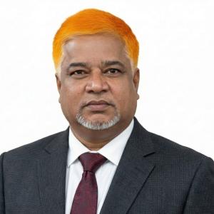 M. A. HannanBrahmanbaria-1, BNP
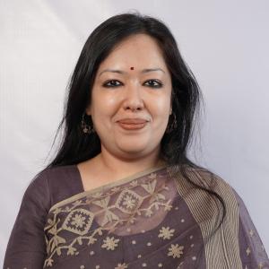 Rumeen FarhanaBrahmanbaria-2, Independent
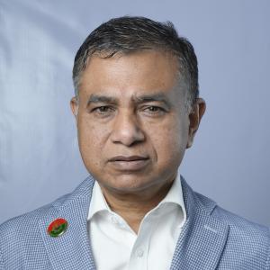 Md. Khaled Hossain MahboobBrahmanbaria-3, BNP
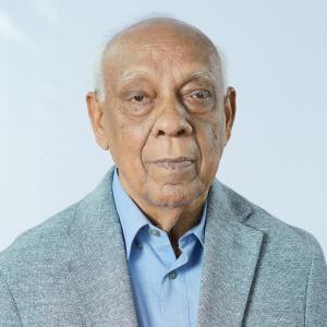 Mushfiqur RahmanBrahmanbaria-4, BNP
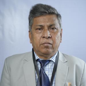 Md Abdul MannanBrahmanbaria-5, BNP
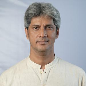 Md. Zonayed Abdur Rahim SakiBrahmanbaria-6, Ganosamhati Andolan
Source: Parliament of Bangladesh | Updated 24 October 2026