Kurigram district
4 parliamentary seats · 9 upazilas. The current member for each seat, according to Parliament's database.
About Kurigram district
Kurigram District is a district of Bangladesh in Rangpur Division. The district is located in northern Bangladesh along the country's border with India. Under British rule, the area was organized as a mahakuma and was not established as a district until 1984 under Chief Martial Law Administrator, Hussain Muhammad Ershad's decentralization programme.
The name
The name "Kurigram" is derived from the words Kuri and Gram. Kuri means "twenty" and Gram means "village" in Kol, a Munda language formerly spoken in the district.
History
The region has historically been viewed as a part of Gaurabardhan or Kamrup. When the Kamrup kingdom was divided into many small kingdoms, the northern half of the Kurigram was controlled by the new polity Cooch Behar, while the southern half became a part of the Uari kingdom. At the beginning of the 12th century, the Khen dynasty emerged as a power in the area of Kurigram, led by such kings as Chakradhwaj and Nilambor. The capital of this new dynasty was located in Chatra, today found in the Ulipur upazila. In 1418, Hosen Shah, the Sultan of Gouro, attacked and defeated Nilambar.
Geography
Kurigram District is located in the northern region of Bangladesh along the border with India. The district is bordered by Jamalpur district of Mymensingh division to the south, Gaibandha, Rangpur and Lalmonirhat districts as well as West Bengal state of India to the west, and the Indian states of Assam and Meghalaya to the east. In total, the district has 278.28 kilometers of international border with India.
People
According to the 2022 Census of Bangladesh, Kurigram District had 605,722 households and a population of 2,329,160, of whom, 21.73% of the inhabitants lived in urban areas. 18.67% of the population was under 10 years of age. The population density was 1,037 people per km2.
Source: Wikipedia, Kurigram District · CC BY-SA 4.0
Places to see of Kurigram
- Jamuna River
- Sonahat Landport
- Sonahat Bridge
- Potaka Bhaban
- Shongram thaky Shadhinota Museum
- North Bengal Museum
- Dhorla Bridge
- Mekurtari Shahi Mosque
- Chandi Mandir
- Dolmancha Mandir
- Bir Protik Taramon Bibi's house
- Naodanga Royal Palace
Notable people of Kurigram
- Taramon Bibi
- Syed Shamsul Haque, poet and writer
- AKM Maidul Islam, politician
- Kanai Lal Sarker, politician
- Anwara Syed Haq, poet and writer
- Abbasuddin Ahmed, singer and composer
- Kasim Uddin, prince of Bhawaiya
- Ajit Roy, singer
- Badol Khondokar, film director and producer
- Raufun Basunia, activist
- Rokanuddaula Mandal, politician
- Golam Hossain, politician
Map of the district
Boundaries from the Election Commission's description of the seats, drawn on the maps of OpenStreetMap (upazilas), OCHA (city corporations) and geoBoundaries (city wards; BBS, 2015); approximate. Background map from OpenStreetMap. 4 seats; tap an area to open that seat's page.
Seats and their members
Kurigram is a district in Rangpur division with 4 seats in Parliament: Kurigram-1 (Bhurungamari and Nageshwari upazilas), Kurigram-2 (Kurigram Sadar, Rajarhat and Fulbari upazilas), Kurigram-3 (Ulipur upazila) and Kurigram-4 (Roumari, Char Rajibpur and Chilmari upazilas). In the 13th Parliament, of these seats Jamaat-e-Islami holds 3 and the NCP 1. In the 12th Parliament (2024), of these seats the Awami League held 2, the Jatiya Party 1 and an independent 1.
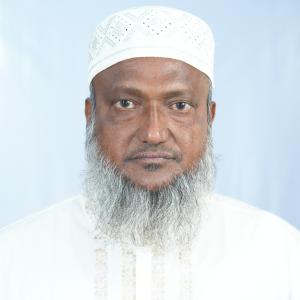 Md Anwarul IslamKurigram-1, Jamaat-e-Islami
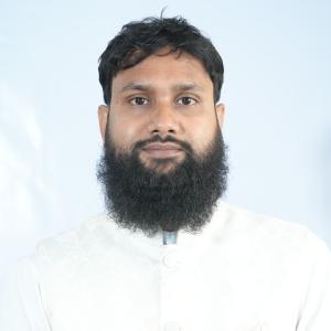 Atiqur Rahman MujahidKurigram-2, NCP
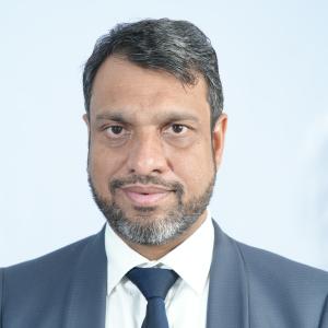 Md Mahbubul AlamKurigram-3, Jamaat-e-Islami
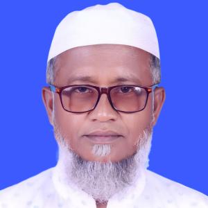 Md Mostafizur RahmanKurigram-4, Jamaat-e-Islami
Source: Parliament of Bangladesh | Updated 24 October 2026