Sherpur district
3 parliamentary seats · 5 upazilas. The current member for each seat, according to Parliament's database.
About Sherpur district
Sherpur District is a district in northern Bangladesh. It is a part of Mymensingh Division. Sherpur District was a sub-division of Jamalpur District before 1984. It was upgraded to a district on February 22, 1984 under Hussain Muhammad Ershad's decentralization programme. Sherpur is located about 197–199 kilometres north of Dhaka, the capital of Bangladesh.
The name
The name "Sherpur" cannot be found in ancient history. In ancient times, Sherpur was called Garh Jaripa. During the rule of the Mughal emperor Akbar, this area was called Dash Kahonia Baju. The previous name of Old Brahmaputra river in this area was Louhitto Sagar which was situated in a vast area from the south border of Sherpur municipality to Jamalpur Ghat.
History
Sherpur region was on the southwest frontier of the kingdom of the Kamarupa in the ancient time. It was known as Garh-Dalipa after its ruler, the Hindu Koch king Raja Dalip Samant. In 1491, the Sultan of Bengal Saifuddin Firuz Shah despatched an army led by Majlis Khan Humayun which crossed the Brahmaputra River and conquered Garh-Dalipa, defeating Raja Dalip and extending Muslim rule into the northern reaches of greater Mymensingh.
Geography
Sherpur District covers an area of 1359.87 sq km, located in between 24°18' and 25°18' north latitudes and in between 89°53' and 90°91' east longitudes. It is bounded on the north by India, on the east by Mymensingh district, on the south and west by Jamalpur district. The main rivers of Sherpur District are Brahmaputra, Kongsho and Vogai.
People
According to the 2022 Census of Bangladesh, Sherpur District had 396,149 households and a population of 1,501,853 million with an average 3.76 people per household. Among the population, 300,674 inhabitants were under 10 years of age. The population density was 1,100 people per km2.
Places to see
Archaeological Heritage and Relics include: Gojni Obokash Kendra, Madhutila Ecopark in Nalitabari, Ghagra Laskar Bari Mosque, Baraduari Mosque at Garhjaripar, Garh Jaripar Fort, Tomb of Darvish Jarip Shah, Tomb of Shah Kamal, Tomb of Sher Ali Gazi, Mughal Mosque at Kasba, Maisaheba Mosque, and Residences of Nay Ani, Arai Ani and Pouney Tin Ani Zamindars.
Source: Wikipedia, Sherpur District · CC BY-SA 4.0
Notable people of Sherpur
- Badrul Alam, medical physician and language activist
- Rakibul Atik, cricketer
- Mohamed Atikuzzaman, footballer
- Muhammad Abdul Bari, politician and businessman
- Monjurul Ahsan Bulbul, journalist
- Chanuar Hossain Chanu, politician
- Shah Rafiqul Bari Chowdhury, politician
- Zahed Ali Chowdhury, politician
- Syed Abdul Hai, army officer
- Khondakar Abdul Hamid, journalist
- Haque family of Sreebardi
- Mahmudul Haque Rubel, politician
Map of the district
Boundaries from the Election Commission's description of the seats, drawn on the maps of OpenStreetMap (upazilas), OCHA (city corporations) and geoBoundaries (city wards; BBS, 2015); approximate. Background map from OpenStreetMap. 3 seats; tap an area to open that seat's page.


Seats and their members
Sherpur is a district in Mymensingh division with 3 seats in Parliament: Sherpur-1 (Sherpur Sadar upazila), Sherpur-2 (Nakla and Nalitabari upazilas) and Sherpur-3 (Sreebardi and Jhenaigati upazilas). In the 13th Parliament, of these seats the BNP holds 2 and Jamaat-e-Islami 1. In the 12th Parliament (2024), of these seats the Awami League held 2 and an independent 1.
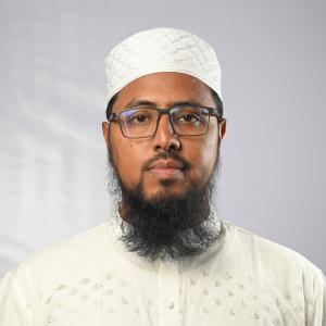 Md. Rashedul Islam RashedSherpur-1, Jamaat-e-Islami
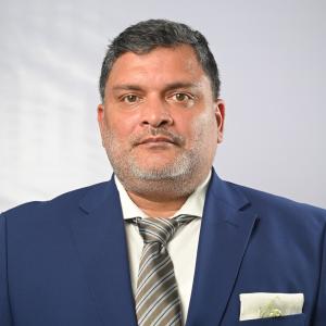 Mohammed Fahim ChowdhurySherpur-2, BNP
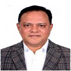 Md. Mahmudul Hoque RubelSherpur-3, BNP
Source: Parliament of Bangladesh | Updated 24 October 2026